
Bay Area Weather Update: As the Bay Area basks in the warmth of record-breaking temperatures, a dramatic shift in weather patterns is set to unfold midweek, bringing with it the ominous arrival of an atmospheric river.
This meteorological phenomenon, characterized by a narrow band of concentrated moisture, has the potential to unleash a deluge of rain and pose significant challenges to the region. With the anticipation of adverse effects, it is crucial for the community to be prepared and heed advisory warnings.
The anticipated consequences of this atmospheric river, and when can we expect the peak of its impact?
The details of this impending weather event and explore the measures being taken to mitigate its potential risks.
Key Takeaways Of Bay Area Weather Update
- Bay Area is experiencing record-breaking temperatures, surpassing normal levels by 10-15 degrees.
- The arrival of a moderate-strength atmospheric river is forecasted, with heavy rainfall and strong winds.
- Anticipated consequences include the risk of flooding, landslides, fallen trees, and power outages.
- The peak of adverse effects is expected on Thursday morning, with increased risk of flooding, hazardous road conditions, and disruptions in public transportation.
Also Read: San Jose Arrested Suspect in Home Invasion Heist
Record Warmth in the Bay Area
Record warmth in the Bay Area has surpassed normal levels by 10-15 degrees, as daytime highs reach unprecedented levels under mostly sunny conditions. The region is experiencing a significant deviation from its typical weather patterns, with several cities anticipating new record highs.
This prolonged period of warmth has caught the attention of residents and meteorologists alike, as it is unusual for this time of year. The warm temperatures have brought a sense of summer-like weather to the region, creating an atmosphere of excitement and enjoyment.
However, concerns about the long-term implications of this heatwave are starting to emerge, as it may have adverse effects on agriculture, water resources, and public health. It is important to monitor these changes closely and take appropriate measures to mitigate any potential risks that may arise.
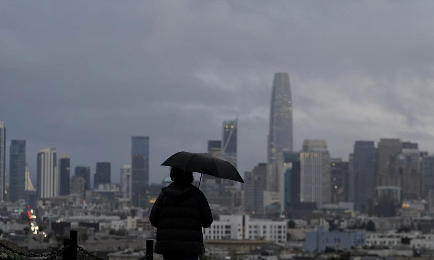
Arrival of an Atmospheric River
Following the record warmth in the Bay Area, a significant change in weather patterns is expected with the arrival of an atmospheric river. Here are the facts:
- Forecasted arrival of a moderate-strength atmospheric river.
- Impact expected from 4 p.m. Wednesday to 4 a.m. Thursday.
- Projected as a level 2 on the ABC7 Exclusive Storm Impact Scale, with potential for upgrade to level 3.
The arrival of an atmospheric river brings a mix of emotions. It is both exciting and concerning for residents. Here are five reasons why:
- Heavy rainfall leading to potential flooding and landslides.
- Strong winds that can cause damage to structures and trees.
- Increased risk of power outages due to the combination of rain and wind.
- Disruption to transportation systems, including road closures and flight delays.
- Concerns over water quality due to runoff from urban areas and potential sewage overflows.
As the atmospheric river approaches, it is important for residents to stay informed and take necessary precautions to ensure their safety.
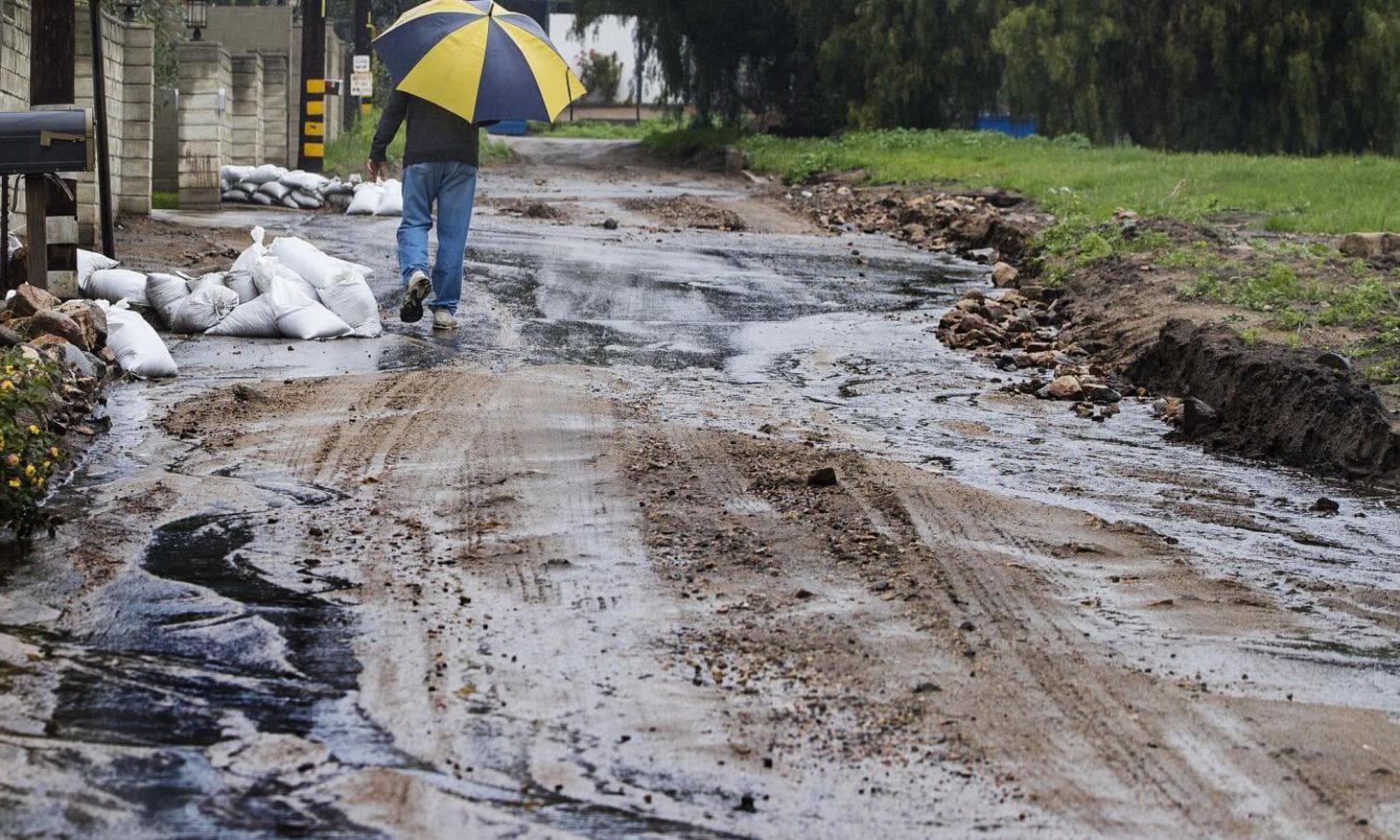
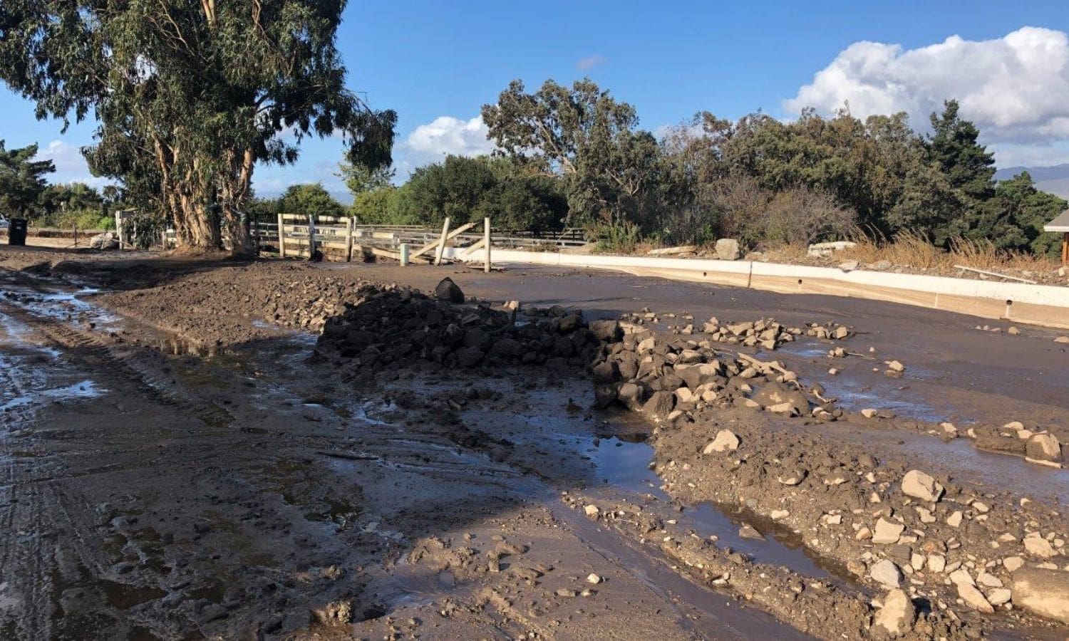
Anticipated Consequences
With the arrival of the atmospheric river in the Bay Area, it is crucial to understand the anticipated consequences and prepare accordingly. The current weather conditions pose several risks that residents should be aware of.
The first concern is the risk of flooding on roads, streams, and the potential for shallow landslides. The heavy rainfall can saturate the ground, leading to increased runoff and overwhelmed drainage systems.
Additionally, the combination of saturated ground and strong winds increases the likelihood of trees falling, which can result in power outages. However, it is important to note that the threat of river flooding is relatively low due to the rivers’ capacity to handle the expected rainfall.
Despite this, individuals should take necessary precautions and stay informed about any potential hazards.
Peak of Adverse Effects
Thursday morning will mark the height of the adverse effects, as heavy rain and strong winds continue to pose potential damages and challenges in the Bay Area.
The current weather conditions bring forth several concerns, including:
- Increased risk of flooding in low-lying areas, potentially leading to property damage and displacement.
- Hazardous road conditions due to reduced visibility and standing water, heightening the risk of accidents.
- Potential power outages as strong winds may cause trees to topple onto power lines.
- Disruptions in public transportation, with delays and cancellations expected due to the adverse weather conditions.
- Possible damage to infrastructure, such as bridges and roads, as heavy rainfall and strong winds put stress on these structures.
Bay Area residents should exercise caution and stay informed about the latest weather updates to ensure their safety during this peak period of adverse effects.
Community Preparedness and Advisory
Are you prepared for the changing weather conditions? As we brace ourselves for the upcoming atmospheric river deluge in the Bay Area, it is crucial for the community to be vigilant and prepared. This weather event has the potential to impact travel, infrastructure, and utilities. To ensure your safety and minimize disruption, here are some key steps to take:
| Community Preparedness | Advisory |
|---|---|
| Stay informed through reliable weather updates | Follow evacuation orders, if necessary |
| Prepare an emergency kit with essential supplies | Secure outdoor objects that could become projectiles |
| Clear gutters and drains to prevent flooding | Avoid driving through flooded areas |

Conclusion Of Bay Area Weather Update
The Bay Area experienced record warmth followed by the arrival of an atmospheric river, bringing heavy rainfall and potential consequences.
The peak of adverse effects is anticipated in the upcoming days, prompting community preparedness and advisories.
It is essential for residents to stay informed and take necessary precautions to mitigate the impact of this deluge.
Our Reader’s Queries
Q1. Does it rain in February in San Francisco?
A. While rainfall is typically light and sporadic, it’s advisable to bring a waterproof jacket to ensure you’re prepared while exploring the city. For those looking to avoid wet weather, consider planning your visit later in the month when the likelihood of rain is reduced.
Q2. Does San Francisco have a rainy season?
A. Situated in a Mediterranean climate, San Francisco experiences a rainy season spanning from November to March, with minimal rainfall anticipated between April and October. The warmest months typically occur in September and October.
Q3. When was the last atmospheric river in the Bay Area?
A. In early 2023, heavy rains fueled by atmospheric rivers led to widespread flooding across the Bay Area. Over a continuous three-week period, relentless storms wreaked havoc throughout California, resulting in extensive flood damage and triggering landslides in the East Bay and Santa Cruz Mountains.
Q4. Does it rain a lot in the Bay Area?
A. The majority of San Francisco’s seasonal rainfall, surpassing 80 percent, occurs from November to March, distributed across approximately 10 days each month. Winter precipitation along the California coast is predominantly attributed to occluded fronts following a west-northwest trajectory, occasionally complemented by cold fronts originating from the Gulf of Alaska.