
Sierra Nevada Faces 10 Ft. Snow Fury: As Winter approaches, a significant storm system is looming over Northern and Central California, particularly targeting the Sierra Nevada region with a forecast of up to 10 feet of snow.
The looming blizzard has prompted warnings and precautions due to potential life disruptions caused by heavy snowfall and strong winds. With travel advisories in place and safety measures being emphasized, residents and authorities are bracing for the impact of this impending snow fury.
Stay tuned to discover how this extreme weather event is expected to unfold and the steps being taken to mitigate its potential consequences.
Approaching Winter Storm Threatens Northern and Central California
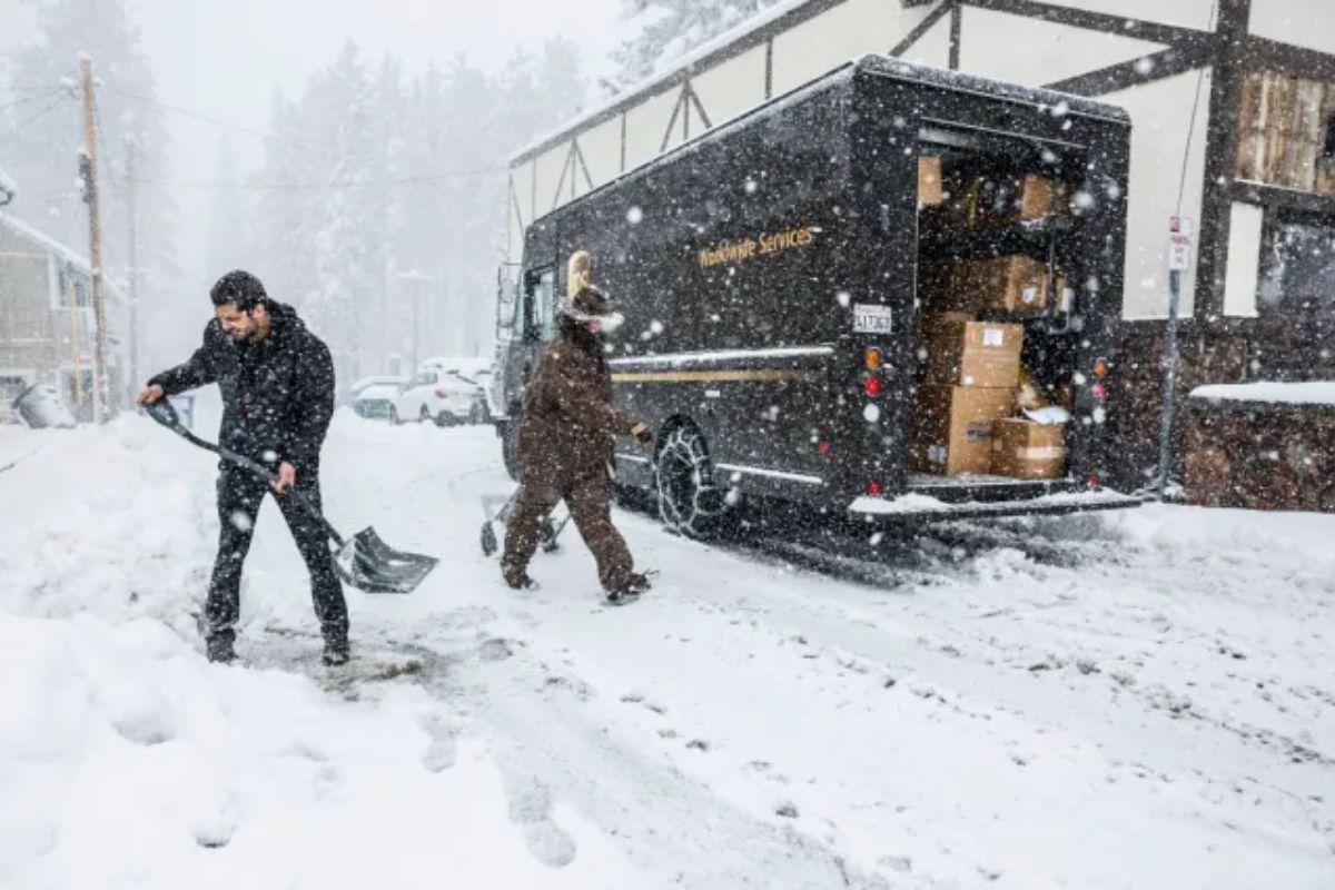
As a powerful winter storm steadily approaches, Northern and Central California face the looming threat of significant disruptions caused by heavy snowfall in the Sierra Nevada region. The impending storm, following its impact on the Pacific Northwest, is expected to bring substantial snowfall, prompting the National Weather Service (NWS) to issue a blizzard warning for the Sierra Nevada and foothills. This warning underscores the potential for hazardous conditions and travel disruptions in the affected areas.
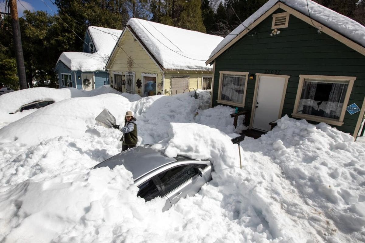
Residents and travelers in these regions should prepare for the possibility of severe weather conditions, including reduced visibility, icy roads, and snow accumulation that could reach several feet. The combination of these factors poses a serious risk to transportation infrastructure, potentially leading to road closures and delays. Furthermore, power outages may occur due to heavy snow weighing down power lines and trees. It is crucial for individuals to stay updated on weather forecasts and advisories, take necessary precautions, and heed any evacuation orders to ensure their safety during this impending winter storm.
Blizzard Warning for Sierra Nevada
With a blizzard warning in effect for the Sierra Nevada region from Thursday at 4 a.m. to Sunday at 10 a.m., residents and travelers are urged to exercise extreme caution due to forecasted peak blizzard conditions on Friday into Saturday morning.
The National Weather Service (NWS) has issued this warning, indicating the likelihood of sustained or frequent wind gusts exceeding 35 mph and visibility dropping to less than 1/4 mile for at least three hours – meeting the blizzard criteria. This warning spans the Sierra Nevada east of Fresno up to the Oregon border, emphasizing the critical need for preparedness and safety measures.
The risk of near-zero visibility poses a significant threat to anyone navigating this area during the specified timeframe. It is imperative for individuals to stay informed about weather updates, avoid unnecessary travel, and take necessary precautions to safeguard themselves and their property during this period of heightened blizzard conditions.
Snowfall Projections and Wind Impacts
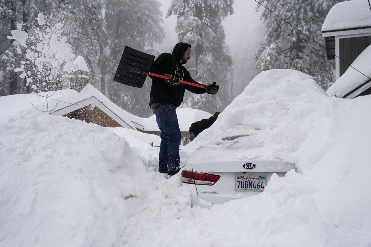
The substantial snowfall projections and high wind speeds associated with the impending Sierra Nevada snowstorm are poised to significantly impact the region’s landscape and pose considerable challenges for residents and travelers alike. Anticipated snowfall ranges from 5-10 ft. in areas above 5,000 ft. elevation, with wind gusts potentially reaching 65 mph. Regions around 3,000 ft. elevation might experience 1-4 ft. of snow, notably affecting areas like the greater Lake Tahoe region. The extreme snow accumulation expected poses a severe threat to travel, particularly over Donner Summit, where over 8 ft. of snow is forecasted, making passage along Interstate 80 challenging.
| Snowfall Projection | Wind Speed Impact |
|---|---|
| 5-10 ft. above 5,000 ft. elevation | Up to 65 mph gusts |
| 1-4 ft. around 3,000 ft. elevation | Severe travel disruptions |
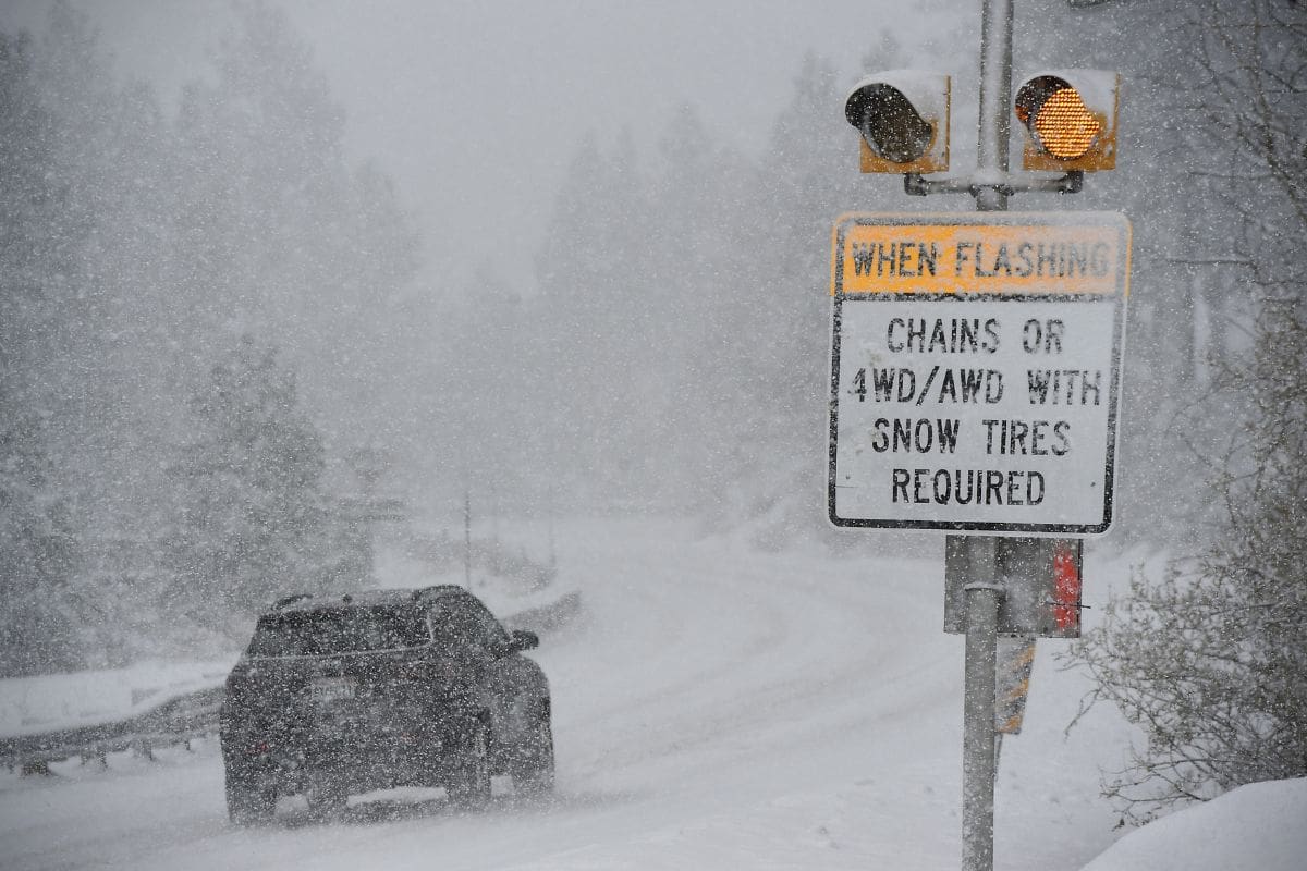
Travel Warnings and Safety Measures
Travelers and residents are urged to prioritize safety and exercise caution in light of the imminent Sierra Nevada snowstorm, as hazardous conditions and significant disruptions are expected across the region.
The National Weather Service (NWS) stresses the extreme dangers of traveling during this storm, advising individuals to refrain from travel if possible. They have explicitly stated, ‘AVOID TRAVEL DURING THIS TIME!’
Whiteout conditions are anticipated, leading to near-zero visibility that could render traffic on Interstate 80 and Highway 50 nearly impossible. Additionally, the influx of cold air from the storm is forecasted to bring temperatures 10-20°F below normal, heightening the likelihood of adverse weather-related impacts.
Given these circumstances, it is crucial for individuals to heed the travel warnings and take necessary safety measures. Planning ahead, staying informed about weather updates, and avoiding unnecessary travel are key steps to safeguarding oneself and others during this severe snowstorm.
Preparation and Outlook
Amidst the looming Sierra Nevada snowstorm and the emphasized need for safety measures, residents in the region are strongly advised to make thorough preparations and maintain a cautious outlook in anticipation of potential disruptions. It is crucial to stock up on emergency supplies, including food, water, medications, and blankets, in case of power outages.
While traveling in these conditions is discouraged, individuals who must venture out should ensure they have extra provisions in their vehicles. The storm is projected to gradually ease by Sunday, with lingering rain and snow expected in the mountains, allowing for assessments and recovery efforts to commence. Staying informed through official channels and heeding warnings from authorities is paramount during this time. Below is a table summarizing key preparations for residents to undertake:
| Preparation | Description | Importance |
|---|---|---|
| Stock Emergency Supplies | Food, water, medications, blankets | Essential |
| Avoid Unnecessary Travel | Discouraged due to hazardous conditions | Highly recommended |
| Stay Informed | Follow updates from authorities and official sources | Critical |
Also Read: Rain Alert In LA County Weather Shift!
News In Brief
A significant winter storm threatens Northern and Central California, with the Sierra Nevada region bracing for up to 10 feet of snow. The National Weather Service issued a blizzard warning spanning from Thursday to Sunday, cautioning residents of peak blizzard conditions likely on Friday into Saturday. Anticipated hazards include reduced visibility and icy roads, prompting travel advisories and safety measures. Snowfall projections indicate 5-10 feet above 5,000 ft. elevation, with gusts up to 65 mph. Travel over Donner Summit and Highway 50 near Lake Tahoe may become nearly impossible. Residents are urged to stock emergency supplies, avoid unnecessary travel, and stay informed for updates on this severe winter storm.
Our Reader’s Queries
Why does Sierra Nevada get so much snow?
The Sierra Nevada climate is influenced by upward-forced air, cooling adiabatically at approximately 6.5ºC per 1,000 meters (3.3ºF per 1,000 feet). During this cooling process, water vapor condenses, giving rise to precipitation—whether rain, hail, sleet, or snow—falling on the western slopes of the Sierra Nevada.
What are the effects of blizzard?
Intense snowfall has the potential to render a region immobile, bringing cities to a standstill by trapping commuters, shutting down airports, halting the supply chain, and disrupting crucial emergency and medical services. The sheer weight of the snow can lead to roof collapses and topple trees and power lines, compounding the challenges faced during such severe weather events.
What are the threats to the Sierra Nevada?
These encompass factors such as wildfires, stream flows, ecological succession, nutrient cycling, and the dynamics between predators and prey.
What are blizzard conditions?
Formally, the National Weather Service classifies a blizzard as a weather event characterized by substantial snowfall or blowing snow, accompanied by winds surpassing 35 mph and visibility reduced to less than 1/4 mile for a prolonged duration, lasting at least 3 hours.