

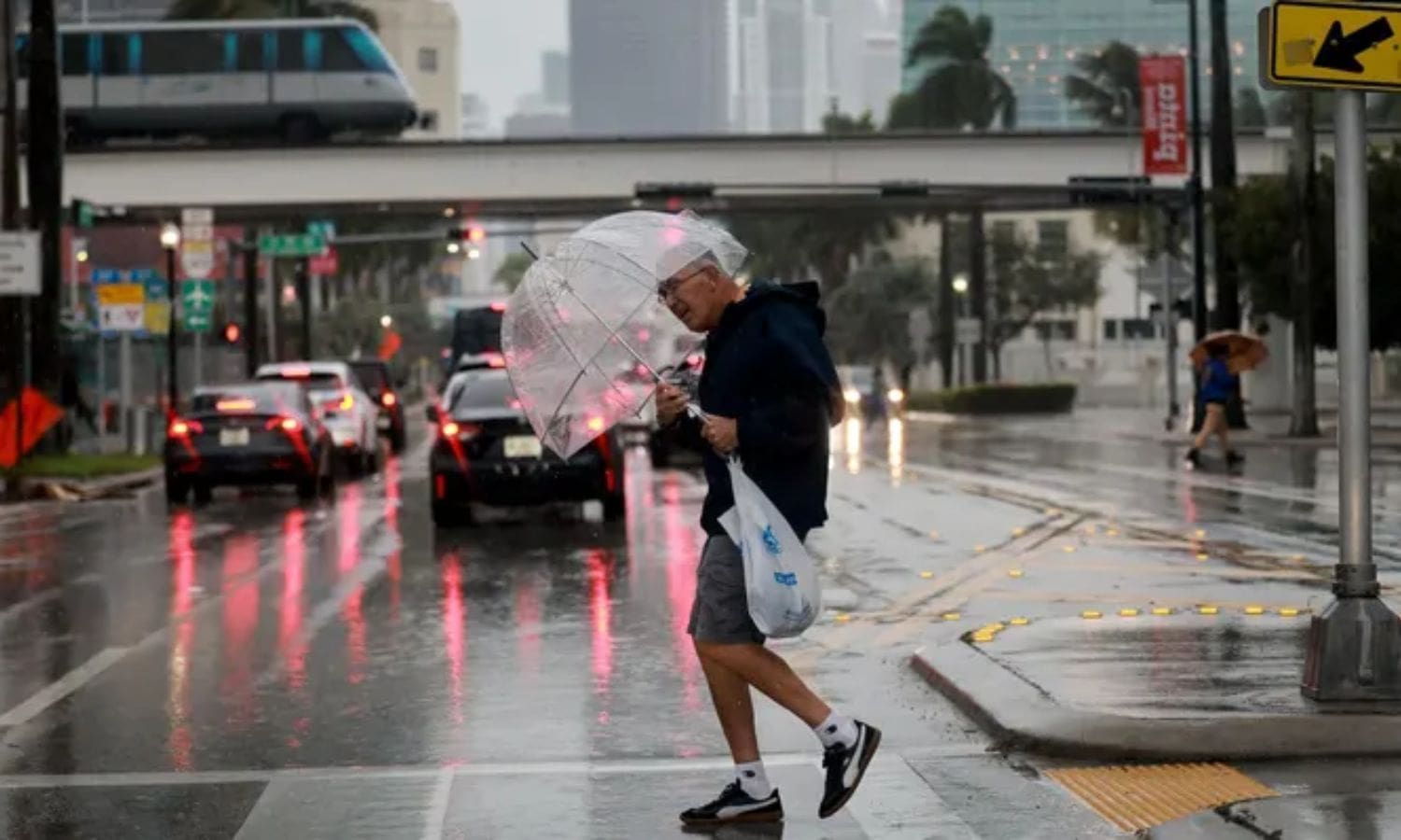
Heaviest Storm Set to Hit Southern California: A significant weather event looms over Southern California, as the region braces itself for the arrival of the heaviest storm in recent memory. With intense rainfall, potential hazards, and even snowfall predicted, it is essential for residents to be informed and prepared.
A comprehensive schedule of the storm, including the timeline and intensity of the rain, as well as an overview of the potential impacts and necessary precautions.
Key Takeaways Of Heaviest Storm Set to Hit Southern California
– Evacuation warnings have been issued in certain areas of Southern California due to the expected heaviest rainfall yet.
– Topanga Canyon residents have been urged to evacuate because of the potential for mud flows, which are more likely in recently affected wildfire areas.
– There is a flood watch issued for the Inland Empire on Monday, and flooding is a major concern in low-lying regions and areas with poor drainage.
– There will be significant drops in temperature and snowfall in mountain communities, with daytime temperatures on Monday ranging from the 50s to 60s and snowfall expected at higher elevations.
Rainfall and Evacuation Warnings
Rainfall in Southern California is expected to reach its heaviest levels yet, prompting the issuance of evacuation warnings in certain areas.
As the last and most potent rain system approaches, residents of Topanga Canyon are being urged to evacuate due to the potential for mud flows. This precautionary measure is vital for ensuring the safety of the residents, as heavy rainfall can saturate the soil and trigger dangerous mudslides. The risk of these mudslides is particularly high in areas that have been recently affected by wildfires, as the loss of vegetation leaves the land more susceptible to erosion.
In addition to the evacuation warnings in Topanga Canyon, a flood watch has been issued for the Inland Empire on Monday, highlighting the severity of the anticipated rainfall. It is crucial for residents to stay informed and prepared for the potential hazards associated with this upcoming storm.
Rain Timeline and Intensity
The anticipated storm in Southern California is projected to bring the heaviest downpour yet, with intensity increasing throughout Sunday and peaking just before Monday’s morning commute. As the storm system moves in, here is what you need to know about the rain timeline and intensity:
– Sunday daytime: Clouds will begin to gather and light rainfall is expected in Ventura County and Los Angeles County.
– Sunday evening: The rain will become heavier, with moderate to heavy showers predicted for these areas.
– Sunday night: The intensity will continue to increase, with heavy rainfall spreading inland towards the mountains.
– Monday morning: Just before the morning commute, the storm will reach its peak intensity, bringing torrential downpours and the highest rainfall rates.
Be prepared for worsening weather conditions throughout Sunday, culminating in a deluge on Monday morning. Stay updated on weather advisories and take necessary precautions to ensure your safety.
Storm Impact and Potential Hazards
With the impending storm, Southern California faces potential hazards and the impact of the heaviest downpour yet. As the storm rolls in, the region can expect a significant amount of rainfall, particularly in Los Angeles and the Inland Empire.
This heavy precipitation can lead to several potential hazards that residents should be aware of. One major concern is the risk of mud flows, especially in areas like Topanga Canyon that are prone to such events. The saturated soil, combined with the steep terrain, creates the perfect conditions for mudslides.
Additionally, flooding is a major concern in low-lying regions and areas with poor drainage systems. It is essential for residents to be prepared for potential power outages, road closures, and property damage.
Stay informed and take necessary precautions to ensure your safety during this intense storm.

Temperature and Snowfall Forecast
Anticipating the heaviest storm in Southern California, the temperature and snowfall forecast reveals significant drops in temperature and snowfall in mountain communities. Here’s what you need to know:
– Daytime temperatures on Monday will range from the 50s to 60s in most areas, bringing cool conditions throughout the region.
– Mountain communities can expect snowfall at higher elevations, creating hazardous driving conditions and potential road closures.
– It is crucial for residents in these areas to prepare for the possibility of power outages and limited access to essential services.
– As the storm passes, there is a potential rebound in temperatures later in the week, but it is essential to remain cautious and stay updated on any weather advisories.
Stay tuned for further updates on the storm and its impact on Southern California.
Stay safe and be prepared for the challenging weather conditions ahead.
Preparation and Weather Outlook
As the heaviest storm approaches Southern California, it is imperative to focus on preparation and diligently monitor the weather outlook. Residents should take proactive measures to ensure their safety and minimize potential damage.
First and foremost, it is crucial to stay informed about the latest updates and warnings issued by local authorities and meteorological agencies. Pay attention to the potential hazards associated with the storm, such as mud flows and flooding, and take appropriate precautions.
Secure loose items and clear drains and gutters to prevent blockages. Stock up on essential supplies, including food, water, batteries, and a first aid kit. Create an emergency plan with your family and review it thoroughly.
Stay tuned to reliable sources of information and be prepared to adjust your plans as the weather conditions evolve. By taking these steps, you can better protect yourself and your property during this upcoming storm.

Also Read: California River Not a Crime, but a Drought Dilemma
Conclusion Of Heaviest Storm Set to Hit Southern California
The heaviest storm to hit Southern California is expected to bring significant rainfall, potential hazards, and even snowfall to the region.
Residents are advised to stay informed about evacuation warnings, as well as the timeline and intensity of the storm.
It is crucial to take necessary precautions and prepare for possible disruptions caused by the storm.
Stay updated with the latest weather forecasts and follow safety guidelines to ensure your well-being and minimize any potential risks.
Q1. Is a hurricane hitting California 2023?
A. In an unprecedented event, California saw its inaugural tropical storm warning issued on August 21, 2023. The cause was the impact of a diminished Hurricane Hilary, making landfall in the southern regions of the state. The remnants of the storm also contributed to rainfall in the northern part of California.
Q2. What is the biggest flood in California?
A. In a historic event, the Great Flood of 1862 stands as the most extensive flood in the recorded history of California, Oregon, and Nevada, affecting the western United States and reaching into parts of British Columbia and Mexico. The flood was triggered by persistent weeks of uninterrupted rains and snowfall, commencing in Oregon in November 1861 and lasting through January 1862.
Q3. When was California’s last 100 year flood?
A. The severity of the Great Flood of 1862 was profound, as intense rainstorms relentlessly battered central California “virtually unabated” from Christmas Eve 1861 until January 1862, according to a detailed account in Scientific American’s 2013 story on “The Coming Megastorms.”
Q4. Why is it raining so much in California 2023?
A. The arrival of wet weather comes in the wake of a drought-busting year and coincides with the development of El Niño, the climate pattern frequently linked to heightened storm activity in California.